“A Most Pleasant Land”
In 1603, Samuel de Champlain began exploring the coastline of what is now Atlantic Canada and New England. He also sailed the length of the Richelieu River to what is now Lake Champlain, travelled westward up the Ottawa River, continued on to Georgian Bay and then headed southeastward across the St. Lawrence River into what is now the United States. His purpose in all these voyages was to find the ideal spot to found New France.
What did the great French explorer see in this New World? The answer can be found in his own writings, where he described all of the places that he visited, representing a good portion of what was to become New France.
Because he dreamed of founding New France, Champlain was always on the lookout for sources of sustenance for future settlers. He noted where fish and game were abundant and where fruit grew wild. He liked what he saw in his explorations:
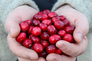
“The country is very pleasant in spring, is covered with extensive and lofty forests, and filled with wood similar to that which we have in France. […] There are also many fine large rivers […] together with an infinite number of fine meadows, lakes, and ponds, through which they pass, where there is an abundance of fish. There are likewise numerous islands which are for the most part cleared up and very pleasant, the most of them containing great quantities of vines and wild fruits.” [1]
Champlain provided an equally detailed account of his lengthy expedition through the country of the Hurons in 1615 and 1616, along what is now Ontario’s Champlain Scenic Route. Modern readers will recognize that certain of the landscapes that Champlain described have remained unchanged ever since.
Voyage Up the Ottawa River to Allumette Island (1613)[2]
When Champlain journeyed up the Ottawa River for the first time, in 1613, he was hoping to find the famous North Sea, which one of his guides claimed to have reached by following this route. In the first written account of travel in what is now Ontario, Champlain described the “Great River” (a translation of the Algonquin word, Kichesippi, for what is now known as the St. Lawrence River) and its tributaries, which he found “fair and broad”.
He described the Petite-Nation River, for example, as “very pleasant in consequence of the fine islands it contains, and the fair and open woods with which its shores are bordered. The land is very good for tillage.“ On the Rideau River, he wrote, there “is a marvellous fall […] it descends a height of twenty or twenty-five fathoms with such impetuosity that it makes an arch nearly four hundred paces broad.” He was speaking, of course, of the Rideau Falls in what is now Ottawa, which are now dammed to control water levels. (Since Champlain’s day, both the Rideau River and the Ottawa River have been transformed by the construction of locks and dams.)
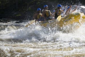
From the Rideau Falls onward, challenges awaited the explorer: the rapids of the Ottawa River. Champlain loved their “marvellous noise” but found their boiling waters and sharp rocks “fearful”. Little did he know that 400 years later, the Ottawa River valley would be a whitewater capital, where rafting enthusiasts came to seek thrills and have memorable experiences that he would have been just as happy to avoid.
Luckily, Champlain found some respite on the “very fine islands covered with vines, nut-trees, and other excellent kinds of trees.” At other points, portage trails — some over a league and a half (nearly 5 km) long—provided a path around troubled waters. Upstream some distance from present-day Ottawa, the Ottawa River presented so many rapids that to avoid them, the expedition took a long detour westward along the Muskrat River, which paddlers now reach via the Champlain Trail Lakes and Astrolabe Lake. Here, he wrote, they passed “through a very fine country, where are small beaten paths, along which one can go easily.”
Next, Champlain stayed a while on what he called the Île des Algoumequins (now Allumette Island), where he reported finding gardens of peas and pumpkins. But bad news also awaited him: there was no access to the North Sea from the Ottawa River. After struggling past so many rapids and survived the assaults of the “mosquitoes, which annoyed us greatly, whose persistency is so marvellous that one cannot describe it,” he therefore called a halt to this expedition. He would travel up the Ottawa River again two years later, but this time with the intention of reaching the country of the Hurons and Georgian Bay.
Voyage Up the Ottawa River to Georgian Bay (1615)[3]
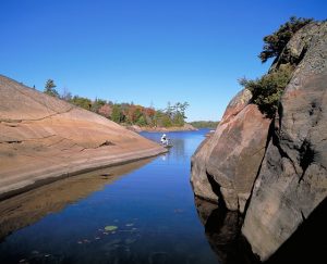
When Champlain returned to the Ottawa River valley in 1615, it was to meet with his allies in Huronia, on southern Georgian Bay. The new route that he took this time proved just as difficult as the one that he had followed in 1613. He found the country separating the Ottawa River from Georgian Bay disagreeable, sterile and flanked with tremendous rocks—a great disappointment to an explorer in quest of arable land.
Champlain’s route down the Mattawa River was blocked by one waterfall after another. On land, the vast fir, birch and oak forests made passage difficult. Champlain did not mince words, describing these as “forbidding and desert lands”. West of Lake Nipissing, the French River country was “still more unattractive than the preceding”, with pine trees clinging to the rocks and no soil worth tilling. But sweet consolations abounded along the riverbanks: “I assure you that there are along the rivers many raspberries, also a marvellous quantity of blueberries, a little fruit very good to eat, and other small fruits.”
Champlain could not have known that the Ottawa and the Mattawa would one day be designated Canadian heritage rivers and protected by aquatic provincial parks where outdoor enthusiasts can enjoy spectacular scenery, paddle canoes, and hike the same historic portage trails that he himself once trod. But he did not fail to see the potential of the north shore of Lake Nipissing, his favourite spot on this part of his voyage. The beautiful woods there teemed with game, and the lake itself was full of fish. Some 700 to 800 natives lived by hunting, gathering and fishing, and the fur trade was already well established.
Champlain would surely be pleased to know that today, many Francophones live along the Sturgeon River in the village of Sturgeon Falls. Here visitors can pick their own strawberries and raspberries at Leisure Farms, operated by the Deschâtelets family, and visit a reconstructed trading post at the Sturgeon River House Museum.
Travelling westward from Lake Nipissing down the French River, Champlain at last reached Lake Attigouautan (Georgian Bay), which he named the Mer Douce (freshwater sea) and described as full of “trout, which are enormously large, [… and] also pike of like size, and a certain kind of sturgeon, a very large fish and of remarkable excellence.”
It was a whole new world for Champlain. He wrote, “These localities seemed to me very pleasant, in comparison with so disagreeable a region as that from which we had come.”
Sojourns on Southern Georgian Bay (1615-1616)[3]
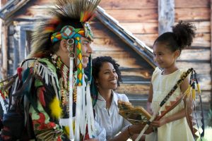
At the start of August 1615, Champlain arrived in Huronia, at the southern end of Georgian Bay. He stayed there for a few weeks, departed on an unsuccessful military expedition with his Huron-Wendat allies (see below), then returned and spent the winter there. He took this opportunity to survey and write about the area, recording his observations of his Huron-Wendat hosts, their customs and the structure of their society.
Champlain travelled among the 18 native villages in the area, with names such as Baie de Matchidache, Baie du Tonnerre, Toanché, Carmaron, and Carhagouha, home to some 2000 warriors. He also travelled westward into Petun territory, of which he wrote: “This country is very fine and fertile, and travelling through it is very pleasant.”
The hills and streams made for a pastoral landscape that reminded Champlain of Brittany, while the trees reminded him of those in France. The land was fertile. He saw grape vines growing and tasted plums, raspberries, strawberries, small wild apples, nuts, wild cherries and black cherries. He described forests of fir, “the regular retreat of partridges and hares.” Along with corn, he saw a variety of other crops, such as pumpkins and vegetables. Champlain was fascinated by this pleasant, abundant country, where the Récollet and Jesuit missionaries would one day come to live.
This region remains just as attractive today. It includes long, sandy beaches such as Wasaga Beach—the longest fresh-water beach in the world—and smaller, municipal beaches to the west. Fine restaurants feature local produce. Visitors can taste apple pie along the Apple Pie Trail and craft beers and ciders on the Saints & Sinners Trail. Outdoor recreation facilities can be found in the mountains, marshes, caves and forests, at Blue Mountain, Scenic Caves and Wye Marsh. Following country roads, tourists can visit historic sites, as well as reconstructed villages at the Huronia Museum and at Ste Marie Among the Hurons.
Amidst all these recreational opportunities, the French influence is still felt and celebrated. There are modern-day Franco-Ontarian communities, notably in Lafontaine and Penetanguishene. But there are also many historic sites bearing witness to the centuries-old presence of the French, from explorers such as Étienne Brûlé and Samuel de Champlain to Récollet and Jesuit missionaries who ended as martyrs for their faith, to voyageurs and finally to farmers who settled the land. Many roadside plaques commemorate events that marked turning points in the history of French Canada.
Military Expedition Across the St. Lawrence (Fall 1615)[3]
But let us return to September 1615, when Champlain left Huronia to command a military expedition with the Huron-Wendat against the Iroquois in what is now the United States. The tone of his writings now changed, and his descriptions became very terse.
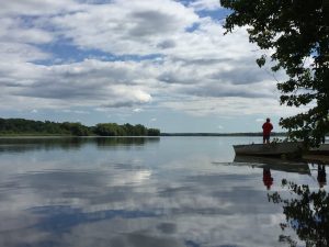
To reach the St. Lawrence River from Georgian Bay, Champlain’s expedition threaded its way through a veritable labyrinth of water, across Lake Couchiching, Lake Simcoe, and Sturgeon Lake, down the Otonabee River, across Rice Lake, and down the Trent River to the Bay of Quinte, which empties into Lake Ontario. At its eastern end, he observed the splendors of the St. Lawrence River, with its large islands and sandy beaches. On his return, he probably proceeded up the Cataraqui River, at the site of present-day Kingston.
Although Champlain’s descriptions from this time are very sober, they still reveal the beauty of the vistas and the abundance of the lakes and forests. For example, he wrote that “it seems as if the trees had been set out for ornament.” As he experienced for himself, the hunting was excellent. Wounded in battle on this expedition, he was brought back to Huronia rather than to Quebec City, where he had founded a colony 11 years earlier. Once he had healed, he joined his hosts on a great hunt for deer, bear, beaver, bustard, duck and white crane.
Between Lake Couchiching and Lake Simcoe, Champlain observed fishing “done by means of a large number of stakes which almost close the strait, only some little openings being left where they place their nets, in which the fish are caught.” These fish weirs are still standing: you can see them at the Narrows in Orillia and along the Ramara Trail. Visitors can still paddle the waters and hunt the forests of the Northumberland-Kawarthas region, where outfitters and resorts abound, or rent a houseboat for a trip along the Trent-Severn Waterway, with its century-old lift locks and Big Chute Marine Railway, enjoying the water and going with the flow.

Planning Your Visit
During his travels through what he called Les Pays d’en Haut (the upper country), Champlain was sometimes charmed and sometimes completely disenchanted. Today, visitors still love the things he loved, but find adventure where he found adversity. That’s why Ontario’s Champlain Scenic Route was created. It offers endless opportunities, from rafting, canoeing, relaxing and fine dining to interpretive experiences at the Canadian Museum of History in Ottawa, the Champlain Trail Museum and Pioneer Village in Pembroke, the French River Provincial Park Visitor’s Centre, the reconstructed villages of Sainte-Marie-Among the Hurons and Huronia in Midland, and the Canadian Canoe Museum in Peterborough. There’s enough for you to fill a book with your impressions and observations, just like the Father of New France did, 400 years ago.
To start planning your trip, visit RouteChamplain.ca. You can also find information on the official website of Destination Ontario.
Written by Andréanne Joly
Translated by Al Daigen
[1] In this article, all quotations from the writings of Samuel de Champlain have been taken from an English translation, Voyages of Samuel de Champlain: 1604 – 1618, edited by W. L Grant and published by Charles Scribner’s Sons, New York, 1907.
[2] Samuel de Champlain, Œuvres de Champlain, published under the patronage of Université Laval by l’abbé C.-H. Laverdière, M. A. Volume I. Voyage de 1613. Chapters III to V.
[3] Samuel de Champlain, Œuvres de Champlain, published under the patronage of Université Laval by l’abbé C.-H. Laverdière, M. A. Voyages et descouvertures faites en Nouvelle France, depuis l’année 1615 jusques à la fin de l’année 1618.

